
Aaron Andrews is a designer in our computer-aided design (CAD) group. We asked him some questions on the geographic information system (GIS), how it can be utilized for projects of all sizes and why it can be beneficial to you, our client.
What is GIS?
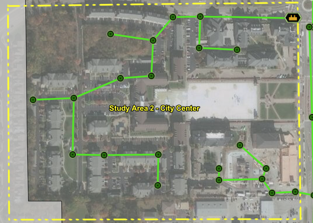
GIS stands for Geographic Information System. It's a system that captures, stores, analyzes and presents spatial data. GIS has several functions and can be used for project site planning and as a representation of real-world objects. Society uses GIS every day, with one of the primary uses being opening maps for directions on our smartphones and computers. It's all around us, even though we may not realize it.
What can GIS do?
We use GIS to make accurate and informed decisions. Multiple data sources determine these decisions. Data can be manipulated and modeled to identify options to help our team and clients make informed choices. Examples include:
- location options for a new wastewater treatment plant
- reports for which gravity mains should be televised, lined or replaced
- track historical water main breaks to produce a "heat" map to display repetitive main breaks.
 How can GIS be used to complement asset management plans or manage assets?
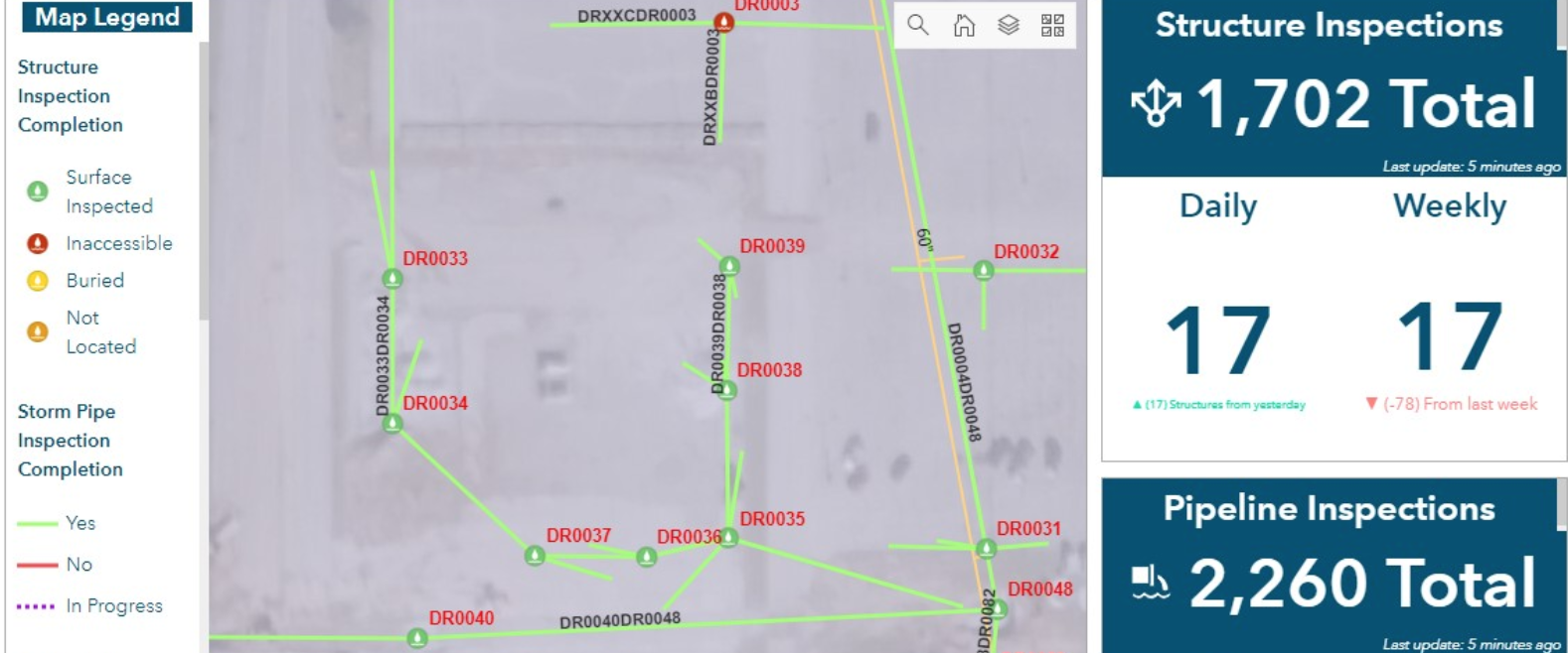
GIS is utilized for multiple reasons. Wessler uses the program to collect and map data of each municipality's asset. Leaders within those municipalities then can make informed decisions based on that information to develop plans for capital improvements and maintenance, as well as gather information about municipalities’ assets in general.
What is our GIS process?
Gathering information is one of the most specific processes in general. Some clients have existing digital and/or physical maps that we transform into GIS data sets. However, other clients may not have any historical maps, meaning we then need to go out in the field to collect data by using global positioning system (GPS) equipment. A GIS map then is created based on the historical information or the field collection data after the data has been through a QA/QC process. That data is then either shared through Arc GIS Online (AGOL) and transferred to the client, or through PDF paper maps.
What are some things you look for/include when putting together GIS maps?
When starting a GIS map, I try to find the best imagery possible that is in the correct coordinate system. If that is wrong, your entire data set can be inaccurate. A clean and easy-to-read representation - or map - is the primary goal, and knowing your audience is a significant factor. Many maps convey a lot of information and can become complicated and hard to understand quickly, so one tested method is to focus the data on displaying or solving specific questions. The quality assurance/quality control process is critical when publishing data as we strive to achieve accuracy, efficiency and a clean data set with all GIS projects.
Which software does Wessler use for GIS?
Wessler utilizes ESRI software, which, for the most part, is the industry standard for many GIS operations. Desktop software includes ArcMap and ArcGIS Pro. Mobile GIS also is used by our field crew, as our data collectors and survey crews are the workhorses for data collection in the field. AGOL is the software behind the scenes that controls the field crew databases and maps. The GPS units our field crews use to collect data are Trimble R2s, of which we have four models. The data collector - or iPad tablet - is paired with the Trimble R2 for data entry. With frequent software releases, this technology is moving at a fast pace with new applications.
In what formats does Wessler provide GIS information?
Wessler mainly uses industry-standard shapefiles and geodatabases. We can provide GIS data in other formats, too.
Why use Wessler and our GIS tech instead of someone else?
Wessler uses the latest up-to-date GIS technology available and we strive to give each client the best overall GIS map(s) for their needs. We listen to our clients and what their wants and needs are. If clients ask for a simple GIS, we provide it. If they want a robust system, we utilize all of the above software to its full potential and publish GIS systems based on clients’ goals and needs.

Tags